Blog

Insurance and Historic Properties

Waterfront houses in Duxbury’s Old Shipbuilder’s Historic District, listed in the National Register of Historic Places in 1986.

The devastating wild fires in California have highlighted a growing national issue – a push by insurance companies to get out of the insurance business by dropping customers in high-risk areas. The increasing number of natural disasters brought on by climate change have put a great deal of stress on the insurance industry. Even before the fires, some companies had already made the decision to pull out of certain states that are regularly hit by increasingly intense disasters, such as Florida. A December, 2024 New York Times article summarizes the issues well.
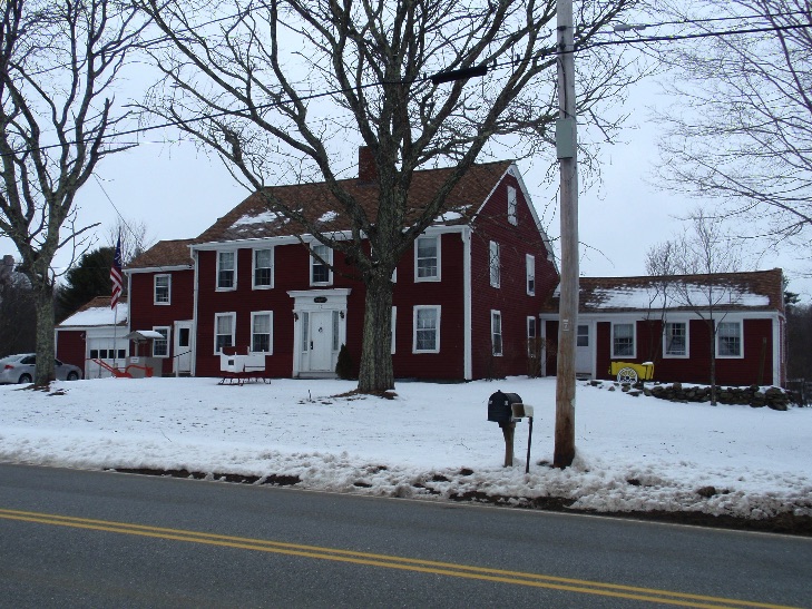
What does this have to do with historic preservation? Well, insurance companies now seem to be using any justification that they can to raise rates or drop homeowners altogether. In my role at the Massachusetts Historical Commission (MHC), I frequently receive inquiries from property owners where their insurance company has raised their rates or will not insure them because their house is included in the Massachusetts Cultural Resource Information System (MACRIS), is listed in the National Register of Historic Places, or is part of a local historic district.

Houses in the Abolition Row Local Historic District in New Bedford.

This fear of historic preservation designations on the part of the insurance companies stems from a lack of understanding about these designations. The insurance companies see these designations and assume they will mean higher repair or replacement costs. They assume there will be a detailed review of the project by a local or state commission. And I have even heard that some insurance companies believe if a house was built in 1780, anything that is used to repair or replace it must be from 1780 – which, aside from being impractical, is just poor preservation practice! Reconstructing a building like that creates a false sense of history, portraying a building as being from 1780 when in fact it was never that assemblage of materials in 1780.

Local historic district designation does require a review process at the local level for any exterior changes to a property in a local historic district. But, exterior only! Local historic districts do not review interiors, so property owners can use whatever materials they would like in there. And many local historic districts are open to alternative or modern materials; the National Park Service recently updated their “Preservation Brief” on substitute materials, helping to clarify best practices around implementing them. Finally, local historic districts in Massachusetts can adopt an exemption for the reconstruction of buildings damaged by fire or other natural disasters, making the replacement process easier (M.G.L. ch.40C §8).

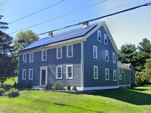
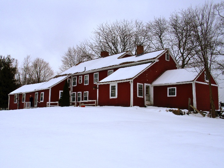
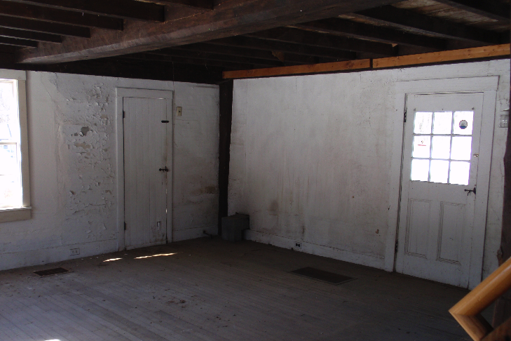
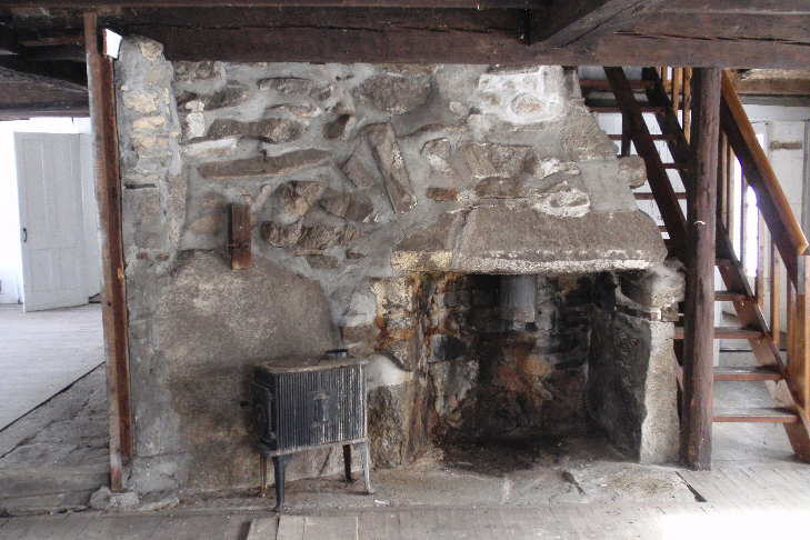
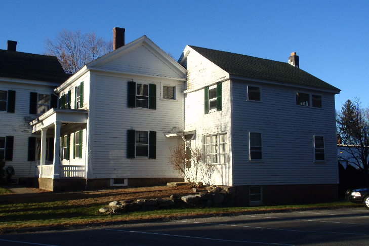
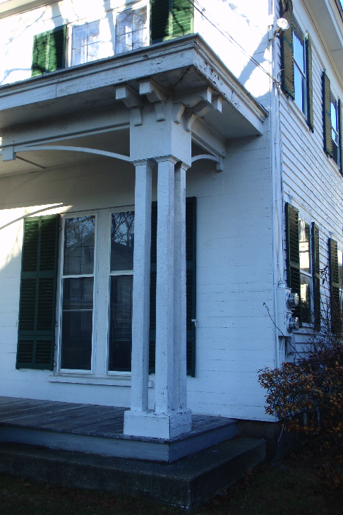
I prepared the National Register of Historic Places nomination for the Jonathan Keyes Sr. House, which was listed in 2019. But, just because it is listed, does not mean it has higher replacement costs.

Unlike local historic district designation, listing in the National Register of Historic Places has very few regulations that will impact a property owner’s use or alteration of their property. While there are review processes at both the state and federal levels, these are only triggered by the use of state or federal permitting, licensing, or funding. Except in extreme disaster situations, most private property owners are not using federal funds to repair their roof, or requiring state permits to rebuild their house. As long as a property owner is following relevant local building and zoning codes, National Register listing will have no impact on their use or alteration of their property. You can read more about the state review of National Register-listed resources here, and the federal review here. Note that it is the state or federal involvement in a project, and not National Register listing itself, that triggers these reviews.

Finally, there is MACRIS – which is not actually a designation at all, but instead a database of all documented historic resources in Massachusetts. Because it is only a database, and not a designation, it does not come with any corresponding regulations. While some communities use MACRIS as their trigger for demolition delay review, that is it – there is no more in-depth review triggered by MACRIS at the local, state, or federal levels.

Because these insurance inquiries have been increasing in frequency, the MHC has developed two memos that address the two most frequent designations – National Register listing and inclusion in MACRIS. Contact the MHC if you would like a copy of these to provide to your insurance agent. This is the approach taken by other state historic preservation offices, as discussed in this National Trust for Historic Preservation webinar on the issue. And the National Park Service has added a question to their National Register FAQ specifically addressing the insurance issue (question four). Hopefully as word spreads among insurance companies, historic preservation designations will be less of an immediate trigger for increased rates or dropped policies.

Now on Facebook!

I now have a Facebook page! Like my page here for updates on my preservation projects, relevant preservation and history articles, and of course pictures of buildings!

"Hysterical" Historical Commissions: What Do They Do?

In September I was appointed by the Westborough Board of Selectmen to the town's Historical Commission as the newest voting member. But what do Historical Commissions do? They often get a bad rap, labeled as the "hysterical" commission, and are thought to be overly concerned with paint color. But in fact Historical Commissions play an important role in maintaining the places that many of us, especially in Massachusetts, love so much. Think about where you'd like to stroll around, spend your vacation - in the mall, or walking around a historic town center like Salem or Rockport? And imagine if all the houses and apartments in every town were modern, all constructed with the same clean lines and beige vinyl siding. You would get sick of that architecture real quick!

Historical commissions help to preserve buildings and landscapes that make a place unique. They make sure a town is conscious of its historic buildings and landscapes, and that they are factored into the continuing growth of the community. Historical commissions help to preserve the variety of architecture that has developed in a place over time, from small houses to mill buildings to downtown stores. This variety not only gives you something to look at on your vacation, but it also provides people with different places to live and work.

A variety of spaces in different conditions provides a variety of options - for housing you can rent one floor of a triple-decker, a loft in a rehabilitated mill building, or a two-bedroom in a newly-constructed apartment building. If you're a business, you might be looking at a downtown storefront, space in a mill that has been converted to a startup incubator, or space in a 1980s office park at the edge of town. All of those choices have a corresponding level of rent and services, and a town that has all those choices can adequately provide for a wide variety of residents and businesses. Through their regulatory powers, local historical commissions in Massachusetts help towns to retain their historic buildings, giving residents and businesses a choice in where they want to live and work.

Chapter 40, Section 8D of the Massachusetts General Laws allows municipalities in the state to create a historical commission "for the preservation, protection and development of the historical or archeological assets of such city or town." The General Laws provide no strict rules about what commissions must do. Most historical commissions conduct inventories of the towns historic resources, completing forms that provide historical information on properties in town, which are useful when making planning decisions. Historical commissions also undertake "bricks and mortar" conservation work, on historic buildings, monuments, or cemeteries in town. But most importantly, especially in Massachusetts, historical commissions are given the ability to implement a demolition delay when a demolition permit is issued for a historic building.

Demolition delay bylaws vary greatly around the state; some municipalities do not even have one. In general, they allow for a delay of anywhere from 90 days to 18 months. The "trigger" for demolition delay also varies - 50 or 100 years old, constructed before a specific year such as 1900 or 1950, listed on the State or National Register, or included in the state's cultural resources inventory. It is up to towns to pass a demolition delay bylaw, and to decide what works best for their town. Historical commissions can also waive the delay, if they feel that the building in question is no longer historically significant (generally, if it has been greatly altered). The delay provides a pause for the developer and the town, some time to see if there is a way the building can be saved, either by incorporating it into the developers plans, selling the parcel to a new, sympathetic owner, or even moving the building to a new location. Importantly, the decision of the historical commission to impose a delay can be overruled by the town's building inspector if safety is an issue with the building. Unfortunately, in towns undergoing rapid development, demolition delay bylaws often become ineffective, because developers will simply factor the wait time into their plan. In Westborough, the Historical Commission can impose a 180-day delay on buildings constructed before 1950.

The Westborough Historical Commission also has control of signs within a 2500' radius around the town's rotary, which covers much of the downtown commercial area. This area is part of a larger National Register of Historic Places district, and having control of signs within it allows the Historical Commission to better maintain the historic nature of the district. In addition to the town's general sign bylaws, the Historical Commission generally asks for signs that are in keeping with the district's historic nature, in color, size, and type. Anyone creating or altering a sign in this district must submit it to the Historical Commission for approval before they can hang the sign. Signs in this district are some of the Historical Commission's biggest business, as the downtown area has improved greatly over the past few years and a number of new businesses have moved in.

Beyond that, a town's historical commission has few other duties. Education is one of the most important aspects of a historical commission - keeping the public informed about historic buildings and landscapes in town, and potential changes to them. Historical commissions are also advisers to other town boards and departments, making sure that they keep the town's historic features in mind when planning new regulations or approving new developments. Historical commissions play a small but important role in helping to maintain the character cities and towns have developed throughout their history. So the next time you're ready to complain about the "hysterical" commission, think about how much you enjoy Massachusetts' historic cities and towns!

Consider volunteering to help govern your city or town! Most municipalities lack volunteers to staff their boards and commissions. It is often a very small time commitment, generally one but sometimes two meetings a month. Municipalities have a number of different boards for different subjects, so check around and see who has vacancies! You generally don't have to be an expert in the field, just a willing and interested citizen!

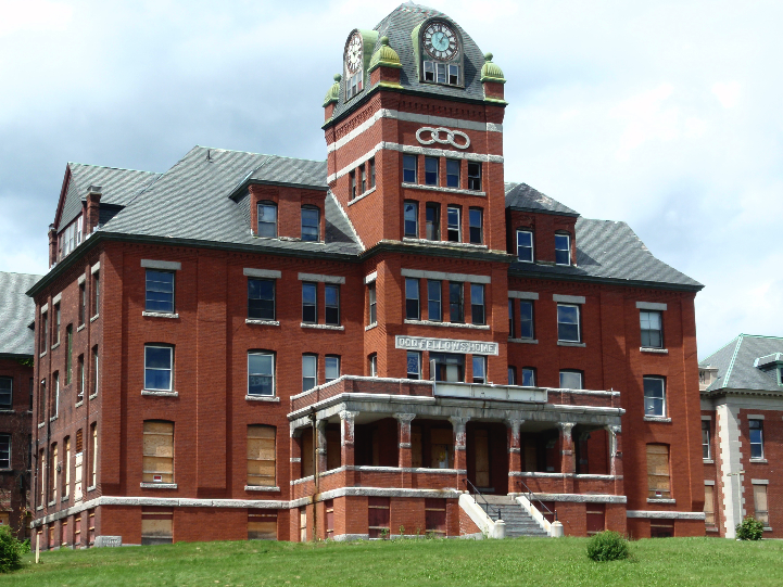
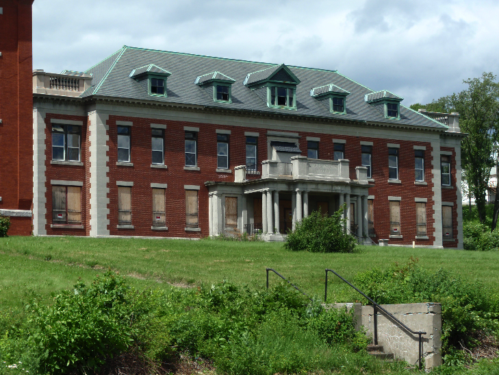
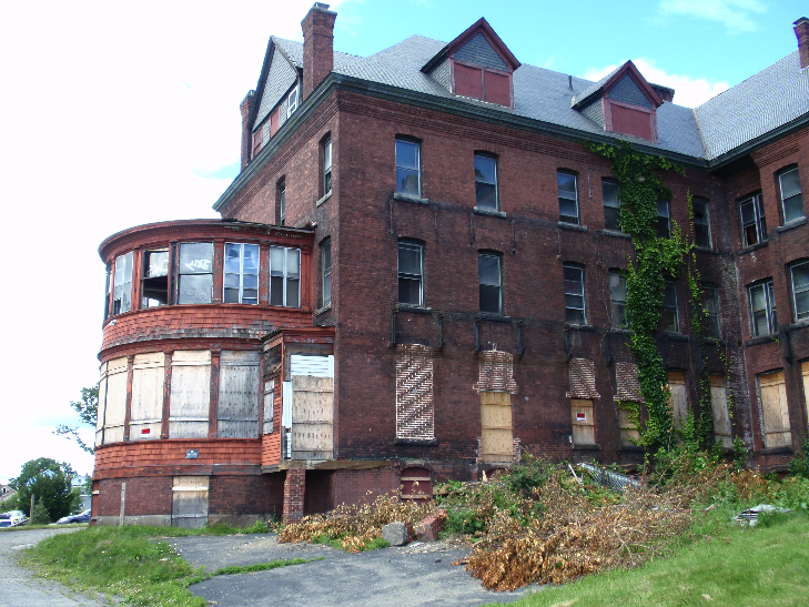
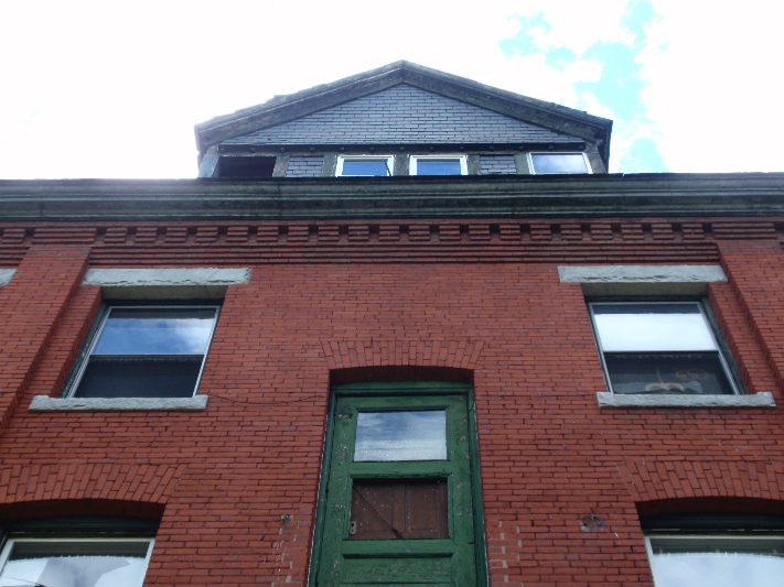
The Odd Fellows Home, Worcester - Lost

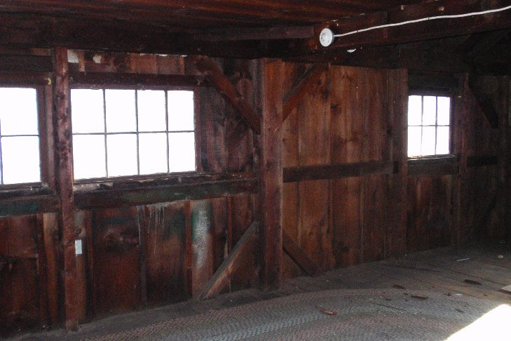
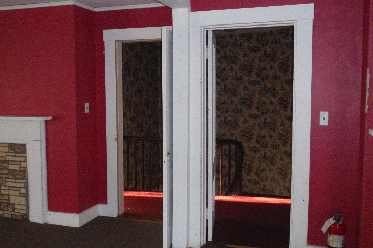
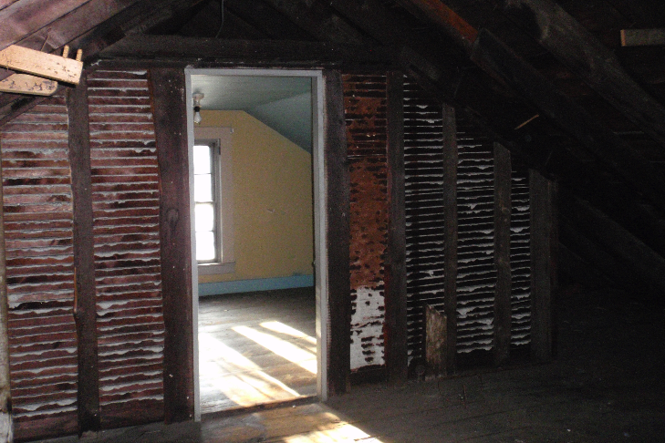
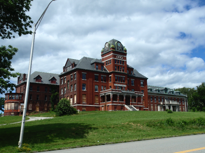
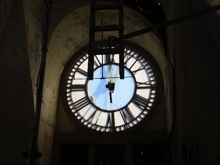
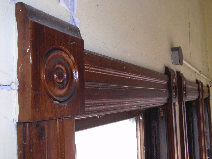
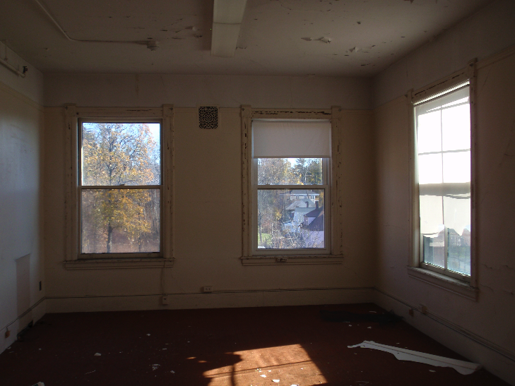
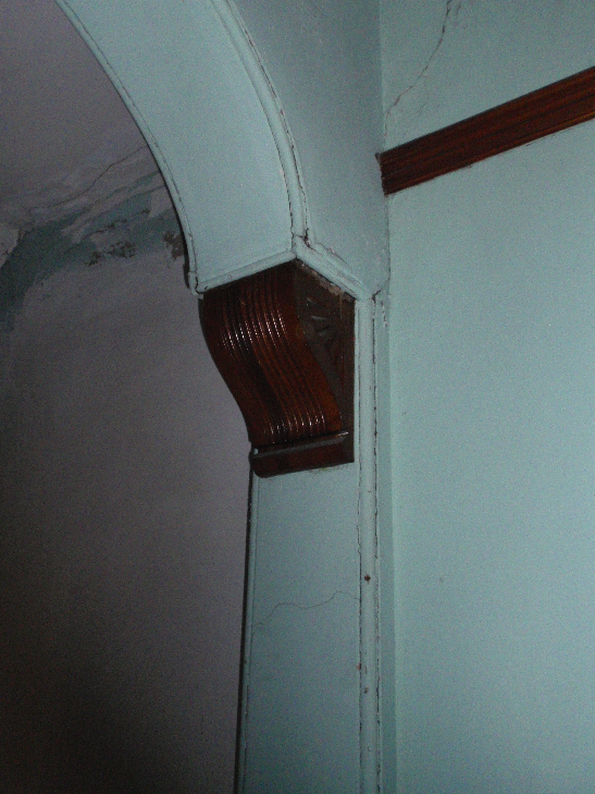
The Romanesque Revival style Odd Fellows Home was opened in 1892 to serve as a home for aged members of the fraternal order. A 1902 Classical Revival wing expanded the building’s capacity. Sited on a hilltop overlooking Worcester, the Odd Fellows Home provided sweeping views of the city for its residents. A much-loved local landmark, the building’s five-story clock tower was visible from around the city. One of a number of hospitals and institutions built on the outskirts of Worcester at the end of the 19th century, the Odd Fellows Home occupied this grand building for nearly 100 years until the organization opened a modern facility next door in 1990. After a portion of the building served as a church for a few years, the building was left vacant and deteriorated from a lack of maintenance. The current owner purchased the Odd Fellows Home with the intent to demolish the building and replace it with a single-story nursing home. The demolition was completed during July and August of 2014.

Below are photographs of the Odd Fellows Home during a visit with the current owner in 2012.

The Toll House, Hopkinton - Update

My previous post on the Toll House and its history can be found here.

Recently, while working on another project, I came across a series of images in the collection of the American Antiquarian Society. I generally do not check AAS during projects, because in the past I've found that their local history collections are not as strong as what I can find at town libraries or historical societies. However these photographs were taken by Harriette Merrifield Forbes (1856-1951) as she documented 17th and 18th century buildings in central Massachusetts. The AAS has a collection of 853 negatives of pictures Forbes took between 1887 and 1945. The AAS lists these digitized photographs by place on their website, and although I was working in another town, I took a look at the few pictures Forbes had taken in Hopkinton. Two of these, taken April 5, 1931, were listed as the Claflin House on Framingham Road. Imagine my surprise when I opened these and found the picture below - what is labeled as the Raftery and Smith house in various sources and at the Hopkinton Library!

Photo from the collection of the American Antiquarian Society.

Photo from the collection of the American Antiquarian Society.

This is a much clearer, higher-quality image of the Smith/Raftery homestead, and is also taken from a different angle than all the other images of the house that I've seen. Fortunately, this angle faces west, and if you look close enough, shows just a little bit of the Toll House to the west of the main house.

Between the front yard trees and the larger house, the Toll House is visible. We can learn a few different things from this photo. First, the road was much further away from the house than it is today. Today, a stone retaining wall is only a few feet in front of the house, but when this photo was taken in 1931, there was a sizeable yard that sloped down to the street. Second, the larger 18th century house appears to be in the area of what is today a driveway onto Weston Nurseries' landscape yard, and it also possibly stood on some wetlands that are in that area. Third, the larger house was still standing when this photo was taken in 1931. So although we don't know exactly what happened to the building (whether it was torn down or moved), it existed a few decades into the 20th century. Today there is a large mid-20th century barn/garage in the area where the larger house stood, suggesting the house was removed around that time and the barn/garage built in its place.

The photograph is a wonderful find, because it confirms what until this point had been speculation, well-documented though it was. The photograph (and the one below, also from AAS's Forbes collection) provide a much more detailed view of the large 18th century Smith/Raftery House. It would have been an impressive building for the time, and would have stood out on the road from Hopkinton to Framingham.

The Toll House, Hopkinton

The Toll House at 123 East Main Street, Hopkinton (image from the town's 1989 survey).

The Toll House at 123 East Main Street, Hopkinton (image from the town's 1989 survey).

Recently I was hired by the Hopkinton Historical Commission to research and document a small house at 123 East Main Street, rumored to be a toll house. The owner is planning to move or demolish the building, and the Historical Commission wanted to make sure there was a record of the building and to substantiate (or disprove) the local lore about the toll house. Buildings usually come with stories that rarely prove to be true - George Washington slept here, this was a stop on the Underground Railroad - but in this case, the house was in fact a toll house.

I always begin my research with maps, as they help to orient you to a property, give you a general idea of who owned a property, and can provide other valuable information. In the case of the Toll House, a map from 1831 proved to be incredibly helpful. Shown below, you can see that there are two dots marked on the map: the first, to the west, is labelled "Toll House," while "N. Smith" is listed as the owner of the dot to the east. Generally, each dot corresponds to a building - this meant that there were two buildings on this property, the Toll House, and N. Smith's house. Currently, the Toll House is the only extant (still standing) building. Looking at maps up to the present, I found that two dots were consistently placed on the property, and that aside from the 1831 map, the same person owned both dots. This indicated that the two buildings continued to stand, and were part of one property after 1831. I also had a rough idea of who owned the property throughout the 19th century (unfortunately, because it saw very little development during the 20th century, Hopkinton has few maps that cover the town from that time and none that cover this area of town).

P2250064.JPG

After I had established that there was indeed a toll house on the site, and that it was a separate building, I began research into what road the toll house could have been for. Today, the house stands on Massachusetts Route 135, which runs from Dedham to Northborough. Digging into turnpikes, I found that the Central Turnpike Corporation was established by an act of the Massachusetts legislature in 1824. The proprietors of the corporation were allowed to build a toll road from Wellesley to Dudley, where the road would enter Connecticut. There was some delay in opening the road, and it was not officially opened until 1830. From Wellesley center, the road followed modern Route 135 through Natick, Framingham, Ashland, and Hopkinton (passing right by the house at 123 East Main Street); in Hopkinton, the toll road split from Route 135 at West Main Street and continued through Upton, Northbridge, Sutton, Oxford, Webster, and Dudley, where it extended down into Connecticut. The toll road was ultimately not successful, and the section in Middlesex County (including Hopkinton) was accepted as a public road in 1836; further sections were opened in the late 1830s, and the section in Connecticut operated until the 1850s.

The route of the Central Turnpike takes it from Wellesley center, down to Dudley, and then into Connecticut. From The Turnpikes of New England by Frederic J. Wood, 1919.

The route of the Central Turnpike takes it from Wellesley center, down to Dudley, and then into Connecticut. From The Turnpikes of New England by Frederic J. Wood, 1919.

With the maps of the property and the information on the Central Turnpike Corporation, it was fairly clear that there was indeed a toll house on the property at some point. And the house that stands at 123 East Main Street is typical of buildings from 1830 - small, with a center chimney plan, and details consistent with the transition between the Federal and Greek Revival styles that was happening at the time. However various local sources suggest that the toll house was demolished or moved at some point in the past - and nearly every source says something different. So I had to figure out if the small house still standing was the toll house, or if there had been another house on the property that was the toll house. What helped clear this up was a photograph in the collection of the Hopkinton Public Library of a larger, early 18th century saltbox-style house. It is labeled as the "Raftery Place," which was the name of the property's owners for nearly 100 years, from 1887 until 1985 (Hopkinton residents will think I spelt Rafferty wrong, the name of a street nearby. But Raftery is how the family name was spelt in deeds, and it was likely corrupted over the years to Rafferty). This photo noted that the Raftery house was moved to New Jersey and rebuilt - making it clear that the small house at 123 East Main Street was in fact the toll house, and likely stood to the west of the much larger, older house, until that house was moved or demolished.

The photograph from the Hopkinton Public Library, labeled "Raftery Place - Toll House Family Home E. Main near Clinton 1706. Moved to N. J. & reblt."

The photograph from the Hopkinton Public Library, labeled "Raftery Place - Toll House Family Home E. Main near Clinton 1706. Moved to N. J. & reblt."

The current owner of the property is Weston Nurseries, a large nursery that has been in Hopkinton for years. The Toll House stands on land they are hoping to develop for a parking lot, and they need the land the house stands on, as there is very little dry land in the area. The Hopkinton Historical Commission voted at their February 25 meeting to impose a six-month demolition delay on the property. This important preservation tool gives the Historical Commission time to work with the owners of a historic building to see if there is a way the building can be saved, either by incorporating it into the owner's plans or even moving it. One possibility for the Toll House includes keeping the building where it is, but selling it to a new owner on a small lot. A few years ago Hopkinton passed a by-law allowing for the creation of a non-conforming lot (a lot smaller than is allowed under current zoning regulations) if it would save a historic house. It was recently used by a developer to save a historic house and barn; by creating a smaller lot for the historic buildings, he was able to build the same number of new houses that he would have if he had demolished the historic structures. The hope is that Weston Nurseries will be able to create a small lot to keep the Toll House where it is, since so much of the building's history is tied to its location. If it was moved to another site, it would still be historic because of its age and condition, but it would no longer be the Toll House standing on the road it once served.

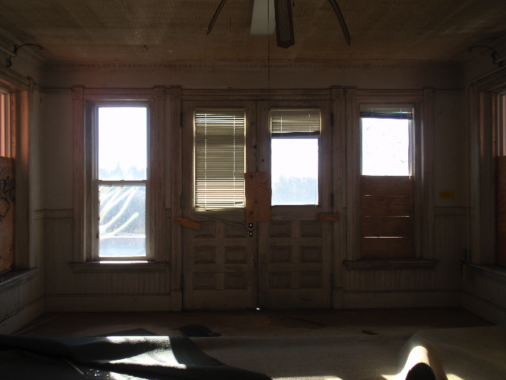
Structurally the house is in good condition, although the interior needs some work. Vandals have broken into the house and torn down some paneling and plaster in one room, but all of the other rooms are in relatively good condition. The house has had some updates over the years, such as new floors, carpets, and even walls, but many of its historic details remain, such as the historic fireplaces and late-19th century two-over-one window sash. Check out a gallery of the Toll House, below.

Dunroving, Worcester - Edward Lavallee

Google Maps Dunroving Developers.png

I have been progressing in my work on the Dunroving neighborhood in Worcester, and wanted to begin giving a description of the developers who worked in the neighborhood. I'll begin with Edward Lavallee, who developed the southern section of the neighborhood, along Flagg Street. Lavallee laid out the streets that would eventually be extended north by E. Whitehead Inc. He was working at roughly the same time as the Aksila brothers, who developed Old Brook Drive off of Moreland Street.

Lavallee did an interview with the Worcester Sunday Telegram in 1975 where he looked back on his career as a builder; Lavallee was 92 at the time. He had no formal training in the construction industry; he began his working career as a moulder at Crompton & Knowles, a prominent Worcester company that manufactured textile machinery. In the 1920s he began purchasing land and building houses, hiring a crew of workmen to do the construction. Lavallee worked all over the city, and estimated that he built around 400 houses during his career, spanning the 1920s to the 1940s. He was know for the quality of his construction, and this is reflected in building permits: the estimated cost of his houses is regularly a few thousand dollars above other houses of the same period.

Aylesbury Road 1.JPG
Brookshire Road 22 02.JPG

Two of Edward Lavallee's very traditional Colonial Revival style houses, at 1 Aylesbury Road and 22 Brookshire Road.

Lavallee purchased approximately 43 acres in the Dunroving area in 1930. It had been part of the Chamberlain-Flagg farm, and included the late 18th century farmhouse at 2 Brookshire Road. Lavallee apparently planned to demolish the farmhouse, but was convinced to let it stand. Of the neighborhood, Lavallee "knew the city was ready for something big in that section," and he set out to make it one of the most impressive residential areas in the city. Working in the 1930s and 1940s, he constructed a variety of Colonial Revival and Cape style houses. The houses are not overly large, but it is evident from their detail and current condition that Lavallee took great care in their construction. Lavallee's new development quickly developed the reputation he wanted, as many of the earliest residents were executives at some of Worcester's prominent companies, such as Crompton & Knowles, Wyman-Gordon, and Norton Company.

Brookshire Road 1.JPG
Flagg Street 126.JPG

2 Brookshire Road differs slightly from other Lavallee houses with its Tudor styling; 126 Flagg Street is a modified Cape.

Nearly all of Lavallee's houses in this neighborhood were done in the Colonial Revival style. What is interesting about the buildings is that there is both variety, but several forms also repeat. It is unclear how Lavallee came up with the designs for his houses; while in his interview he mentions hiring a good foreman and a good crew of builders, he makes no mention of the design process. So it is unknown if he designed the houses himself (unlikely, given that he had no formal training) or if he had someone else design the buildings for him. One possibility I considered in my research is that he built Sears houses. During the early part of the 20th century, the Sears Roebuck company sold complete house kits by mail-order. The houses came in a variety of styles and sizes, to suit all tastes and locations. And while one of Lavallee's Capes that repeats several times appears very similar to a Sears house, without interior access to the building, it is hard to say for sure if he did indeed build Sears houses. It is also possible that he took the designs of the Sears buildings and used them as models, building his own houses from scratch to the company's designs.

Flagg Street 122.JPG
35attleborod.jpg

Lavallee's house at 122 Flagg Street appears very similar to the Attleboro, a Sears house from 1935. Lavallee used this Cape with the same detailing several other times in the neighborhood, as seen below at 5 Brookshire Road and 136 Flagg Street.

Brookshire Road 5.JPG
Flagg Street 136 02.JPG

In addition to this neighborhood, Lavallee also worked nearby, further west down Flagg Street. The neighborhood includes, Gaskill Road, Rittenhouse Road, Beeching Street, and Frontenac Road. In that area he built a mix of Tudors and Colonial Revivals; the same quality and variety is reflected in that neighborhood. In directories from the time he was working, Lavallee is listed as living at 37 Flagg Street, at the corner of Rittenhouse Road and Flagg Street, suggesting he was living where he was working. The house is a very large two-story brick Colonial Revival with four full-height columns supporting a portico over the middle of the house; it is in keeping with Lavallee's style, and it is very likely that he built the house himself. Aside from his 1972 interview, there is almost no other information available about Lavallee. He was a prolific local builder, but he was just one of many local builders working in the middle of the century, a time when the country was experiencing a huge building boom as many city residents sought a more suburban lifestyle.

Edward Lavallee Photo.png
Aylesbury Road 7.JPG

Edward Lavallee, and another one of his Colonial Revival houses at 7 Brookshire Road.

Greenwood Memorial Pool and Bath House

PC030025.JPG

One of my current projects is preparing a National Register of Historic Places nomination for the Greenwood Memorial Pool and Bath House in Gardner, Massachusetts. The building is city-owned, and up until 2012 was still an operating public pool. It was also used for a number of years by the Gardner High School swim team, which won numerous state championships while practicing at the pool. However the building has long suffered from maintenance issues, and in the fall of 2012 the city decided to close it. An early 1990s outdoor pool that sits to the west of the building is still opened and maintained by the city. Local preservationists hope to convince the city to reopen the pool, or to reuse the building while preserving its historic integrity. Since its construction in 1914, the building has been an important part of Gardner's landscape.

Beginning in the middle of the 19th century, Gardner developed a large furniture making industry. Today it is known as the Chair City and the Furniture Capital of New England. One of the men credited with jump-starting Gardner's furniture industry is Levi Heywood. He and his brothers founded the Heywood-Wakefield Furniture Company, which made furniture in Gardner well into the 20th century. Heywood's descendants were prominent philanthropists, donating numerous buildings to the city they called home. Among these were the Levi Heywood Library, the Heywood Hospital, and the Greenwood Memorial Pool and Bath House.

PC030033.JPG

In 1914, Levi Heywood's grandson, Levi Heywood Greenwood, wrote a letter to the citizens of Gardner. In it, he proposed to build a bath house at his own expense, which he would then donate to the city, to be maintained by the city for the use of its citizens. Greenwood intended the building to be a monument to his parents, Alvin M. and Helen R. Greenwood. At Town Meeting in April of 1914, Gardner's citizens accepted Greenwood's offer, and the Greenwood Memorial Bath House was opened on July 6, 1915. The Bath House had been opened for three days before that, and 5,000 visitors came in just those three days. The Bath House was built on a 3.5-acre lot at the southern end of Crystal Lake. To its west, a low-lying area was maintained as an outdoor swimming pool. The bottom of this "pool" was paved with asphalt in the 1970s, and it was filled in after a modern in-ground pool was constructed just a little further west on the lot in the early 1990s.

PC030060.JPG

The Bath House was an important addition to the city of Gardner. Even in the first few decades of the 20th century, many residents still did not have clean running water in their houses. The Bath House provided a cheap place for residents to get clean. It was common in industrial towns for those residents who had become wealthy to give back; Massachusetts is full of libraries and public buildings named for local philanthropists. Gardner was a thriving industrial city at the time, and the Bath House stands as a symbol of that industrial past. Throughout the 20th century, even as Gardner's industrial base began to decline, the Bath House was available for citizens to use for a very nominal fee. Even into the 1960s, the original 1915 fee for use was maintained.

PC030121.JPG

The building was constructed at a cost of $80,000, and it was designed by the firm of Wiley & Foss of Fitchburg. It was done in the Classical Revival style, which was incredibly popular at the turn of the 20th century for public buildings. Important features include the Doric columns on either side of the main entry, the patterned brickwork at the front and sides of the building, and the carved exposed rafter tails visible at the eaves. One interesting feature of the building that ties it even more closely to Gardner's furniture industry is the way it was originally heated. When the Bath House was first built, the Heywood-Wakefield Furniture Company factory was just a few blocks away. To heat the pool, steam was pumped from the furniture factory to the Bath House basement.

Below is a gallery of the interior of the Greenwood Memorial Pool and Bath House

Dunroving, Worcester - The Background

For the past several months I have been working on a major project at Preservation Worcester: surveying and inventorying a neighborhood in the city that has a mix of 1930s-1940s Colonial Revival houses and 1960s-1970s Modern (or Contemporary) houses. The neighborhood was brought to our attention by a resident, Kristina Wilson, who is also a professor of Art History at Clark University. She found it interesting because the neighborhood has long been known for its large Jewish population, and she was interested in the connection between the Jewish residents and the Modern houses. I began my work on the neighborhood in the spring, and this past week I assisted Kristina with a class she is co-teaching this fall with a geography professor, Deb Martin. The class is focused on suburbia and the idea of freedom. On Friday, I helped the class begin writing inventory forms about another nearby street (Denison Road) that was nominally part of the development and has 15 1930s Colonial Revival houses on it. 

Google Maps Dunroving.png

The area is in the northwest of Worcester, roughly bound by Flagg Street on the south, Salisbury Street on the east, and Moreland Street on the north and west.  Salisbury Street is a main Worcester artery that heads northwest out of downtown towards the neighboring town of Paxton. The area was originally on the outskirts of the city, and as such was mostly rural, with large farms existing into the 20th century.

Brookshire Road 2.JPG

The land the neighborhood now sits on was originally part of the Chamberlain-Flagg farm. The Flagg family owned the property for most of the 19th century, and it was finally sold out of the family in the 1920s, when the developers of the neighborhood purchased it. One of the developers intended to demolish the mid-18th century Chamberlain-Flagg House, but luckily he chose not to, and the house still stands at 2 Brookshire Road. It is thought to be one of the oldest, if not the oldest, houses in Worcester.

1922 Map.png

As seen above in 1922, the area was still divided into large parcels. 2 Brookshire Road, the Chamberlain-Flagg house, is part of the two-triangles property on Flagg Street. This would eventually be purchased by Edward Lavalle, who would also purchase much of the "(E. Flagg Est.) L. A. Kent" land to the north of it. To the northeast of Edward Lavallee, the large "Wm. MacKay" estate, listed as 92 acres, was purchased by E. Whitehead, Inc. This included land on both sides of Salisbury Street which the firm would develop for single-family housing. The final area covered by my research is the land owned by "P. H. Durrey" to the north of the Whitehead's land. This was purchased by two brothers, Ames and Anton Aksila, who would go on to develop multiple neighborhoods in this area. Below is a modern map showing the developers and their respective parcels.

Google Maps Dunroving Developers.png

The lot marked with an "X" that separates the Whitehead's land into two parcels was purchased by John H. Eresian, an Armenian immigrant. The lot was originally five acres, but Eresian split it into two 2.5-acre lots that would become 162 and 164 Flagg Street. Eresian would keep 162 for himself, and sold 164 to a fellow Armenian immigrant. Both houses are done in the Spanish Eclectic style; however while Ereisan designed and built 164 himself, he hired the architect Jasper Rustigian to design 162. Interestingly, Rustigian was also an Armenian immigrant.  Today the lot of 164 maintains the original long and narrow 2.5-acre configuration, but the lot of 162 was subdivided in the 1950s and 1960s, and now makes up the eastern side of Meadowbrook Road.

The house at 162 Flagg Street, designed by Jasper Rustigian. The Spanish Eclectic styling of 162 and 164 Flagg Street stand out in the neighborhood, which is full of more traditional Colonial Revival houses.

The house at 162 Flagg Street, designed by Jasper Rustigian. The Spanish Eclectic styling of 162 and 164 Flagg Street stand out in the neighborhood, which is full of more traditional Colonial Revival houses.

This is the start of a series of posts highlighting this neighborhood and my work there. Up next, information on the Aksila brothers and their work in the area. 

Hopkinton Center Architectural Tour

Recently I gave an architectural walking tour on behalf of the Friends of Hopkinton 300th Anniversary Celebration. The tours lasted approximately an hour, and highlighted the different architectural styles visible throughout Hopkinton Center.

Hopkinton developed during the early part of the 19th century as a major manufacturer of boots and shoes. A local resident, Joseph Walker, invented the pegged shoe sometime in the 1810s; this was a way of attaching the sole and the upper of a shoe using small wooden pegs, and it made the process of making shoes much easier. By the middle of the century the process had been mechanized, and shoemaking had moved from small "ten-footers" on family farms to large factory buildings in the center of town. Unfortunately, several large fires at the turn of the 20th century destroyed much of Hopkinton's factory infrastructure. After the fires, many of the boot and shoe companies chose to relocate elsewhere, and the town saw little development until Interstates 90 and 495 made the town an outer suburb of Boston in the 1980s and 1990s. So while today Hopkinton's downtown does not have the large factory buildings that you might find in other historic manufacturing cities, many of the houses and shops of the workers and factory owners are still standing. My walking tour focused on these, and showed how the different styles in Hopkinton are representative of its development throughout the 19th century. Below are a few of the highlights from the tour.

8 Hayden Rowe Street - the Lee Claflin House

8 Hayden Rowe Street - the Lee Claflin House

The Lee Claflin House on Hayden Rowe Street, just off of the Common, is one of the more impressive Greek Revival buildings in Hopkinton. It is a high-style example, with an end-gable layout, fluted Ionic columns, an elaborate door surround, and elongated first-floor windows. The house was built for Claflin by his son, Hon. William Claflin, who was governor of Massachusetts from 1869 to 1871. It is unclear if William ever spent any significant time in this house, but one of the librarians on tour mentioned that the homeowner has been doing some work on the building, and in one of the walls found a metal stamp or press with William's name on it.

28 Hayden Rowe Street - the Samuel Crooks House

28 Hayden Rowe Street - the Samuel Crooks House

Just a few houses down from the Claflin House is the Samuel Crooks House, another high-style example, but this time of the Italianate style. Hopkinton was still growing rapidly during the second half of the 19th century, when the Italiante style was popular. Its features include asymmetrical massing with a side entrance and projecting bays, elaborate woodwork at the eaves and around windows and doors, and large panes of glass in the windows. Because glass production had advanced so significantly by the middle of the century, later styles often feature one-over-one or two-over-two sash, such as seen here on the Crooks House.  Crooks and Claflin were both prominent Hopkinton factory owners who had money to spend on large and ornate buildings like these.

82-84 Pleasant Street - image from the town's 1980s survey

82-84 Pleasant Street - image from the town's 1980s survey

Because Hopkinton Center began to grow in the 1830s and 1840s, residents built a different form of housing than what you might find in other factory or mill towns, such as Uxbridge, Grafton, or Worcester. This double house on Pleasant Street from the 1850s is representative of what you might find in those towns, but is one of the only double houses remaining in Hopkinton Center. By the 1850s, much of Hopkinton Center had already been built up with smaller end-gable Greek Revival cottages, leaving little room for larger buildings such as this.


21 Hayden Rowe Street - the Greek Revival cottage form which is found throughout Hopkinton Center

21 Hayden Rowe Street - the Greek Revival cottage form which is found throughout Hopkinton Center

One common feature on these smaller Greek Revival cottages is that they were often updated with Italianate features at the end of the 19th century. It is rare to see one of these houses in Hopkinton Center that does not have brackets at the eaves or a hood over the door. 

28 Main Street - the Hopkinton Supply Company Building

28 Main Street - the Hopkinton Supply Company Building

Hopkinton's only building listed on the National Register of Historic Places, the 1906 Hopkinton Supply Company building is representative of later development in Hopkinton. A fire at the turn of the century had destroyed much of the northern side of Main Street, resulting in a new Town Hall and a row of several new shops in the 1900s. The Hopkinton Supply Company was one of these new buildings, but it stands out from its neighbors for its construction - it is a mail-order building. The building was ordered from the George L. Mesker Company of Evansville, Indiana, shipped to Hopkinton, and assembled on-site. The whole building is constructed of galvanized pressed steel, another unique and interesting feature of the building. Because Hopkinton had little to no growth after the turn of the century, this is one of the few newer buildings in Hopkinton Center.