Blog

The Toll House, Hopkinton - Update

My previous post on the Toll House and its history can be found here.

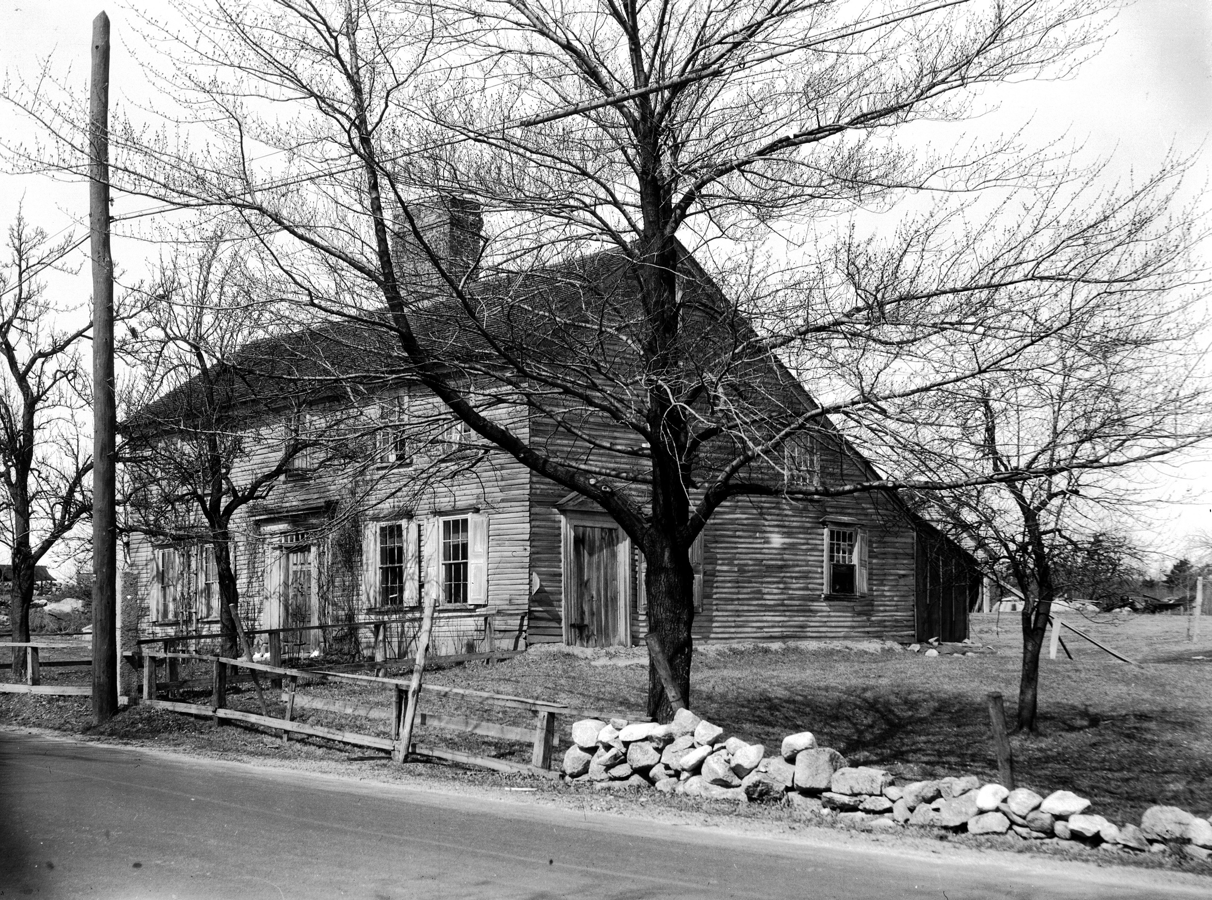
Recently, while working on another project, I came across a series of images in the collection of the American Antiquarian Society. I generally do not check AAS during projects, because in the past I've found that their local history collections are not as strong as what I can find at town libraries or historical societies. However these photographs were taken by Harriette Merrifield Forbes (1856-1951) as she documented 17th and 18th century buildings in central Massachusetts. The AAS has a collection of 853 negatives of pictures Forbes took between 1887 and 1945. The AAS lists these digitized photographs by place on their website, and although I was working in another town, I took a look at the few pictures Forbes had taken in Hopkinton. Two of these, taken April 5, 1931, were listed as the Claflin House on Framingham Road. Imagine my surprise when I opened these and found the picture below - what is labeled as the Raftery and Smith house in various sources and at the Hopkinton Library!

Photo from the collection of the American Antiquarian Society.

Photo from the collection of the American Antiquarian Society.

This is a much clearer, higher-quality image of the Smith/Raftery homestead, and is also taken from a different angle than all the other images of the house that I've seen. Fortunately, this angle faces west, and if you look close enough, shows just a little bit of the Toll House to the west of the main house.

Between the front yard trees and the larger house, the Toll House is visible. We can learn a few different things from this photo. First, the road was much further away from the house than it is today. Today, a stone retaining wall is only a few feet in front of the house, but when this photo was taken in 1931, there was a sizeable yard that sloped down to the street. Second, the larger 18th century house appears to be in the area of what is today a driveway onto Weston Nurseries' landscape yard, and it also possibly stood on some wetlands that are in that area. Third, the larger house was still standing when this photo was taken in 1931. So although we don't know exactly what happened to the building (whether it was torn down or moved), it existed a few decades into the 20th century. Today there is a large mid-20th century barn/garage in the area where the larger house stood, suggesting the house was removed around that time and the barn/garage built in its place.

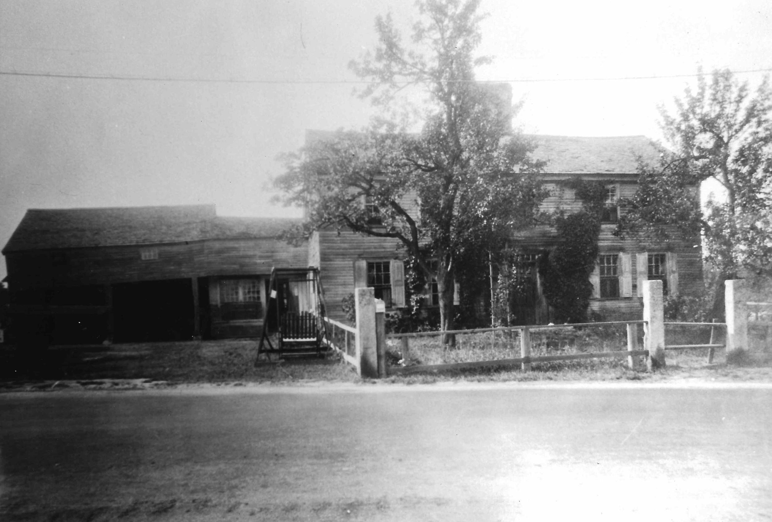
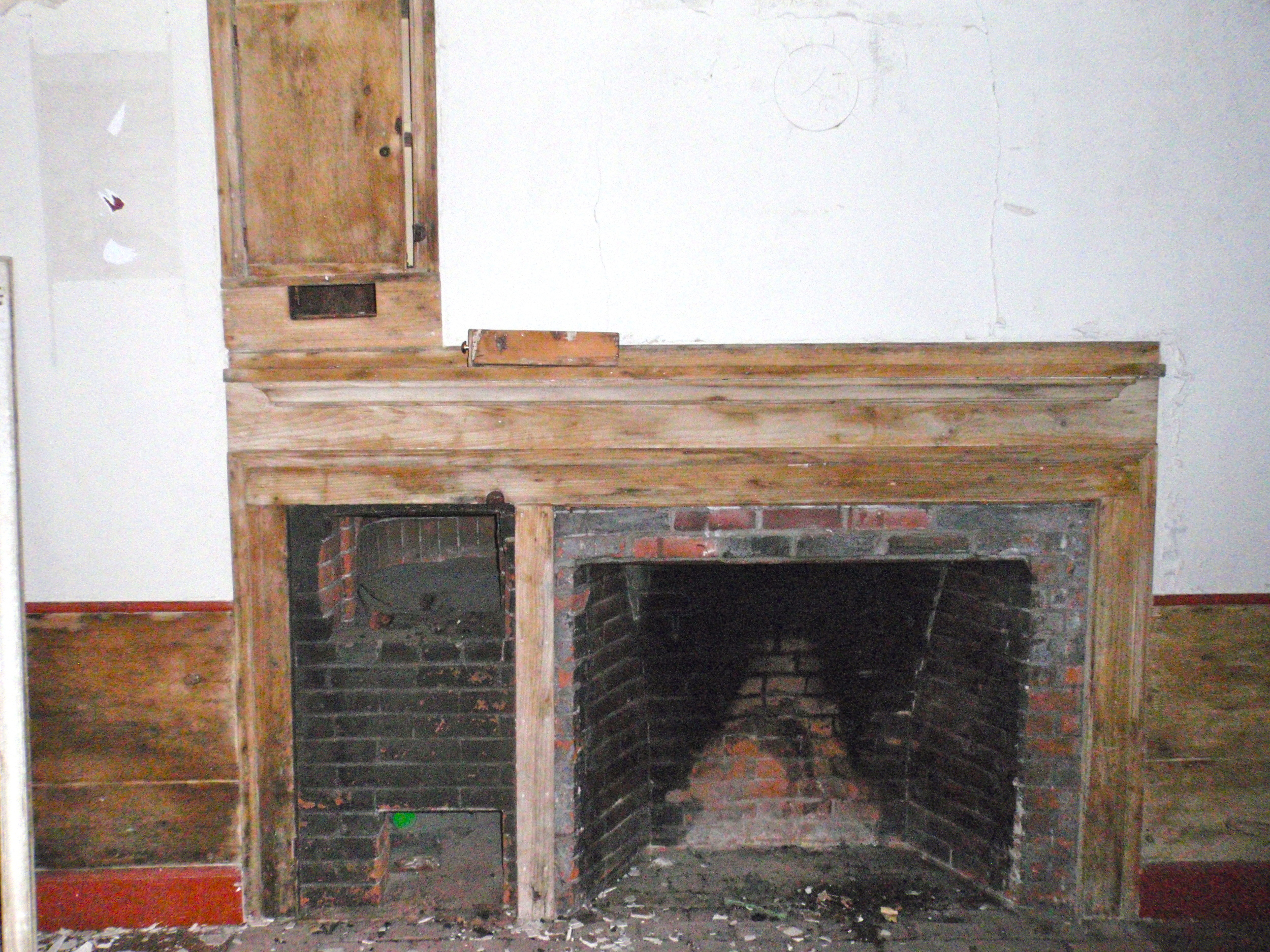
The photograph is a wonderful find, because it confirms what until this point had been speculation, well-documented though it was. The photograph (and the one below, also from AAS's Forbes collection) provide a much more detailed view of the large 18th century Smith/Raftery House. It would have been an impressive building for the time, and would have stood out on the road from Hopkinton to Framingham.

The Toll House, Hopkinton

The Toll House at 123 East Main Street, Hopkinton (image from the town's 1989 survey).

The Toll House at 123 East Main Street, Hopkinton (image from the town's 1989 survey).

Recently I was hired by the Hopkinton Historical Commission to research and document a small house at 123 East Main Street, rumored to be a toll house. The owner is planning to move or demolish the building, and the Historical Commission wanted to make sure there was a record of the building and to substantiate (or disprove) the local lore about the toll house. Buildings usually come with stories that rarely prove to be true - George Washington slept here, this was a stop on the Underground Railroad - but in this case, the house was in fact a toll house.

I always begin my research with maps, as they help to orient you to a property, give you a general idea of who owned a property, and can provide other valuable information. In the case of the Toll House, a map from 1831 proved to be incredibly helpful. Shown below, you can see that there are two dots marked on the map: the first, to the west, is labelled "Toll House," while "N. Smith" is listed as the owner of the dot to the east. Generally, each dot corresponds to a building - this meant that there were two buildings on this property, the Toll House, and N. Smith's house. Currently, the Toll House is the only extant (still standing) building. Looking at maps up to the present, I found that two dots were consistently placed on the property, and that aside from the 1831 map, the same person owned both dots. This indicated that the two buildings continued to stand, and were part of one property after 1831. I also had a rough idea of who owned the property throughout the 19th century (unfortunately, because it saw very little development during the 20th century, Hopkinton has few maps that cover the town from that time and none that cover this area of town).

P2250064.JPG

After I had established that there was indeed a toll house on the site, and that it was a separate building, I began research into what road the toll house could have been for. Today, the house stands on Massachusetts Route 135, which runs from Dedham to Northborough. Digging into turnpikes, I found that the Central Turnpike Corporation was established by an act of the Massachusetts legislature in 1824. The proprietors of the corporation were allowed to build a toll road from Wellesley to Dudley, where the road would enter Connecticut. There was some delay in opening the road, and it was not officially opened until 1830. From Wellesley center, the road followed modern Route 135 through Natick, Framingham, Ashland, and Hopkinton (passing right by the house at 123 East Main Street); in Hopkinton, the toll road split from Route 135 at West Main Street and continued through Upton, Northbridge, Sutton, Oxford, Webster, and Dudley, where it extended down into Connecticut. The toll road was ultimately not successful, and the section in Middlesex County (including Hopkinton) was accepted as a public road in 1836; further sections were opened in the late 1830s, and the section in Connecticut operated until the 1850s.

The route of the Central Turnpike takes it from Wellesley center, down to Dudley, and then into Connecticut. From The Turnpikes of New England by Frederic J. Wood, 1919.

The route of the Central Turnpike takes it from Wellesley center, down to Dudley, and then into Connecticut. From The Turnpikes of New England by Frederic J. Wood, 1919.

With the maps of the property and the information on the Central Turnpike Corporation, it was fairly clear that there was indeed a toll house on the property at some point. And the house that stands at 123 East Main Street is typical of buildings from 1830 - small, with a center chimney plan, and details consistent with the transition between the Federal and Greek Revival styles that was happening at the time. However various local sources suggest that the toll house was demolished or moved at some point in the past - and nearly every source says something different. So I had to figure out if the small house still standing was the toll house, or if there had been another house on the property that was the toll house. What helped clear this up was a photograph in the collection of the Hopkinton Public Library of a larger, early 18th century saltbox-style house. It is labeled as the "Raftery Place," which was the name of the property's owners for nearly 100 years, from 1887 until 1985 (Hopkinton residents will think I spelt Rafferty wrong, the name of a street nearby. But Raftery is how the family name was spelt in deeds, and it was likely corrupted over the years to Rafferty). This photo noted that the Raftery house was moved to New Jersey and rebuilt - making it clear that the small house at 123 East Main Street was in fact the toll house, and likely stood to the west of the much larger, older house, until that house was moved or demolished.

The photograph from the Hopkinton Public Library, labeled "Raftery Place - Toll House Family Home E. Main near Clinton 1706. Moved to N. J. & reblt."

The photograph from the Hopkinton Public Library, labeled "Raftery Place - Toll House Family Home E. Main near Clinton 1706. Moved to N. J. & reblt."

The current owner of the property is Weston Nurseries, a large nursery that has been in Hopkinton for years. The Toll House stands on land they are hoping to develop for a parking lot, and they need the land the house stands on, as there is very little dry land in the area. The Hopkinton Historical Commission voted at their February 25 meeting to impose a six-month demolition delay on the property. This important preservation tool gives the Historical Commission time to work with the owners of a historic building to see if there is a way the building can be saved, either by incorporating it into the owner's plans or even moving it. One possibility for the Toll House includes keeping the building where it is, but selling it to a new owner on a small lot. A few years ago Hopkinton passed a by-law allowing for the creation of a non-conforming lot (a lot smaller than is allowed under current zoning regulations) if it would save a historic house. It was recently used by a developer to save a historic house and barn; by creating a smaller lot for the historic buildings, he was able to build the same number of new houses that he would have if he had demolished the historic structures. The hope is that Weston Nurseries will be able to create a small lot to keep the Toll House where it is, since so much of the building's history is tied to its location. If it was moved to another site, it would still be historic because of its age and condition, but it would no longer be the Toll House standing on the road it once served.

Structurally the house is in good condition, although the interior needs some work. Vandals have broken into the house and torn down some paneling and plaster in one room, but all of the other rooms are in relatively good condition. The house has had some updates over the years, such as new floors, carpets, and even walls, but many of its historic details remain, such as the historic fireplaces and late-19th century two-over-one window sash. Check out a gallery of the Toll House, below.